blah blah blah
Mt. Livermore and Cotton Mountain
Length: 4.4 mile loopDifficulty (click for info): Easy
Elevation Gain: 1280 feet (+120 feet on return)
Rating (click for info): 6/10
Elevation: 1508' (Livermore) and 1281' (Cotton [true summit])
Prominence: 229' (Livermore) and 278' (Cotton)
Driving Directions:
Trailhead and parking area are on Rt. 113 in Holderness, NH. Look for a small dirt lot on the left, just on the roadside, 1.0 mile north of Rt. 3. You'll pass the open water of Cotton Cove, then round a leftward bend with several entrances to private driveways just before the trailhead. It is also 10.7 miles southwest of the junction with Rt. 109 in Center Sandwich. Click here for a Google map.
About the Hike:
Notice: The trails described here are among a set of trails maintained by the Squam Lakes Association which are closed annually for mud season. The trails remain closed for at least a month starting from snowmelt.
The two southernmost summits on the crescent shape of the Squam Range are Mt. Livermore and Cotton Mountain. Significantly lower than the 2000-footers dominating the rest of the range, they nevertheless provide great views over Squam Lake, which are naturally closer-up than their neighbors. The trails that traverse the two low mountains are part of the same well-cared-for SLA network that encompasses the rest of the range, but explore generally more gentle terrain than is found in other areas, with the exception of one rocky stretch climbing up Cotton Mountain. You will also find this area to be a bit quieter than the always-bustling Morgan-Percial loop and Rattlesnakes.
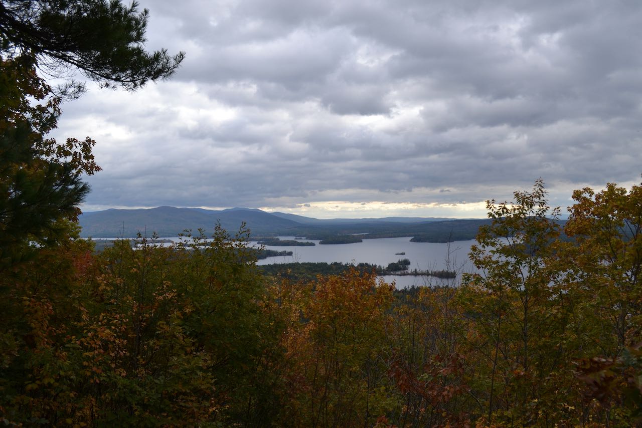
From the trailhead, head out on the Cotton Mountain Trail, winding through a tunnel of brush. It eventually makes a rightward curve and after a quarter mile emerges in the remains of an old gravel pit. Follow the left edge of the sandy clearing back into the woods at 0.35 miles total. As you approach the end of the old road through the pit, turn right as the trail becomes a footpath that quickly approaches the steep front of the hillside. After crossing another woods road, it maneuvers upward on zigzags up the sharp incline, which becomes increasingly rocky as you climb higher. You ascend for a total of 0.4 miles to reach the southeastern, and slightly lower, summit of the double-peaked Cotton Mountain. Just before the forested highpoint, you will find a cleared out window over the treetops from which you can enjoy a little view of Red Hill and the eastern portion of Squam Lake, with the Ossipee Mountains in back.
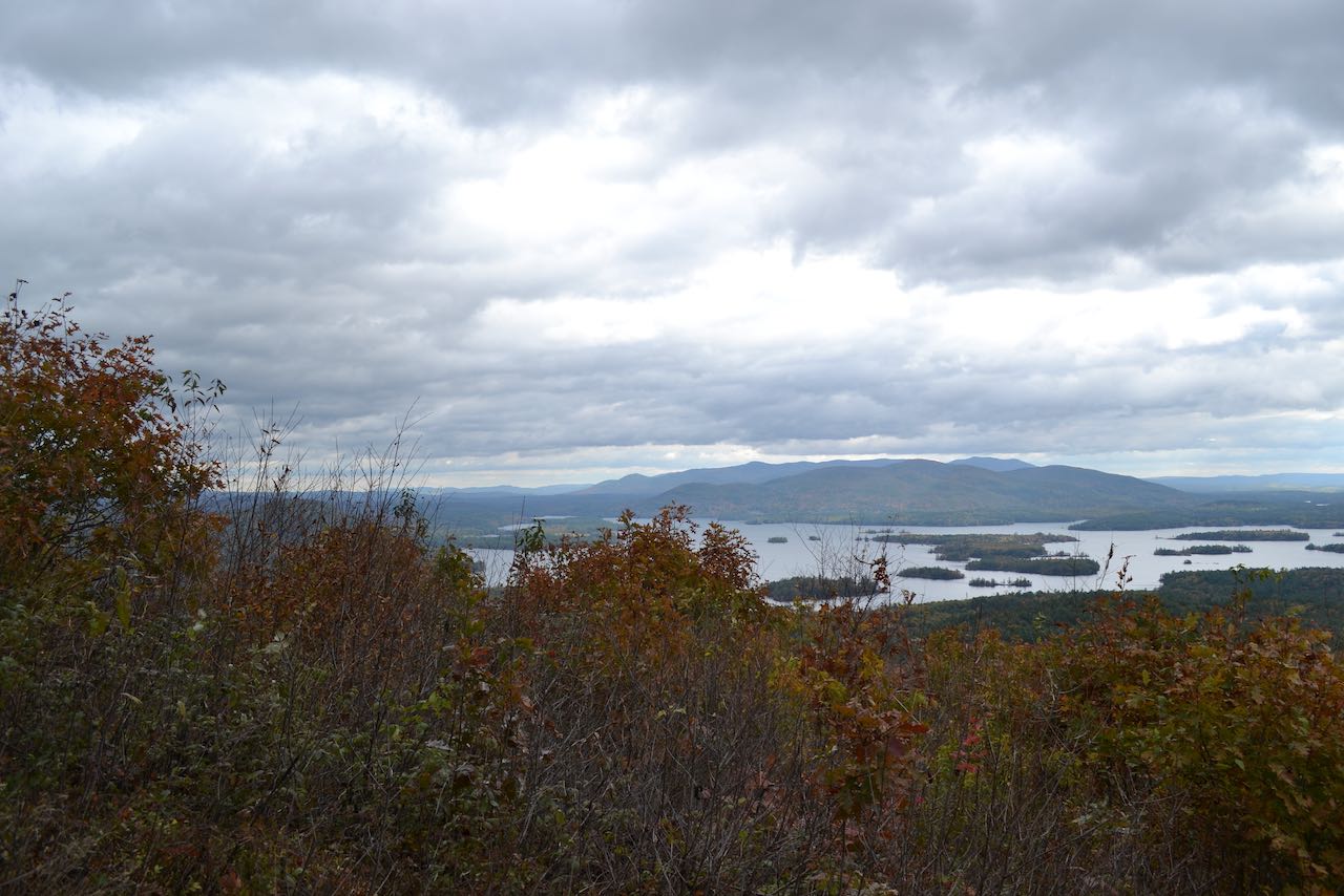
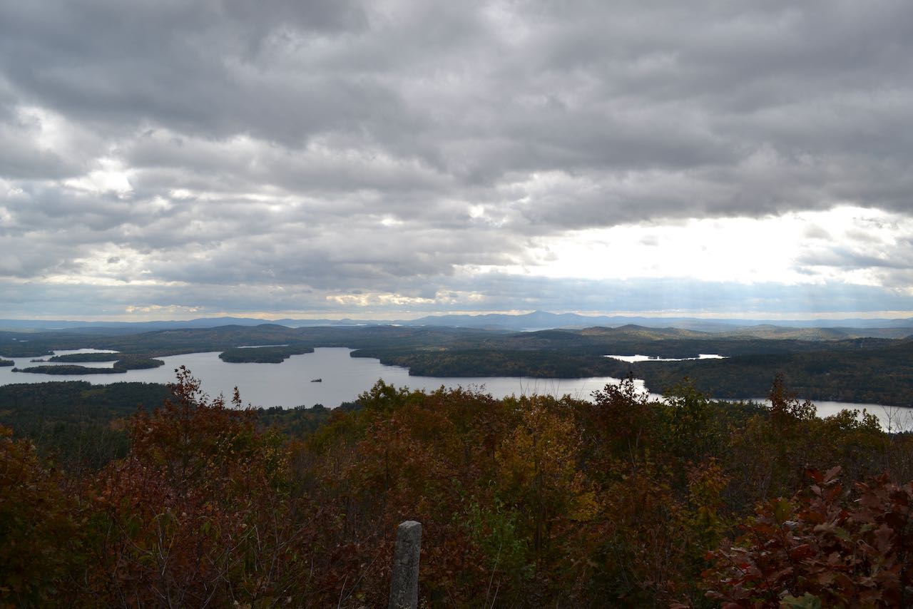
Swinging over the summit, the trail (now the Crawford-Ridgepole Trail) soon drops down underneath a towering canopy of sparse pines, following the yellow diamonds. After squeezing through a slot in a boulder, the trail drops down to the bottom of the valley between Cotton Mountain and Mt. Livermore after 0.35 miles. The trail runs flat for a ways, crossing some small runoffs on log bridges. After a tenth of a mile, it begins climbing again at an easy pace. In just over a half mile, bear left as Prescott Trail comes in from the right. The trail continues briefly across the hillside on the west slope down from the summit, then begins a series of tight and level switchbacks to climb 0.4 miles up to the grassy summit clearing on Mt. Livermore. From here you can enjoy a nice sweeping view over the entirety of Squam Lake. Starting from Red Hill, with the Ossipee Range now more visible behind it on the left, the view moves across some distant low hills to Copple Crown and the Moose Mountains. The Belknap Range is in the center of the view, while over to the right are New Hampton's Beech Hill, and the bumpy ridge of Hersey Mountain.
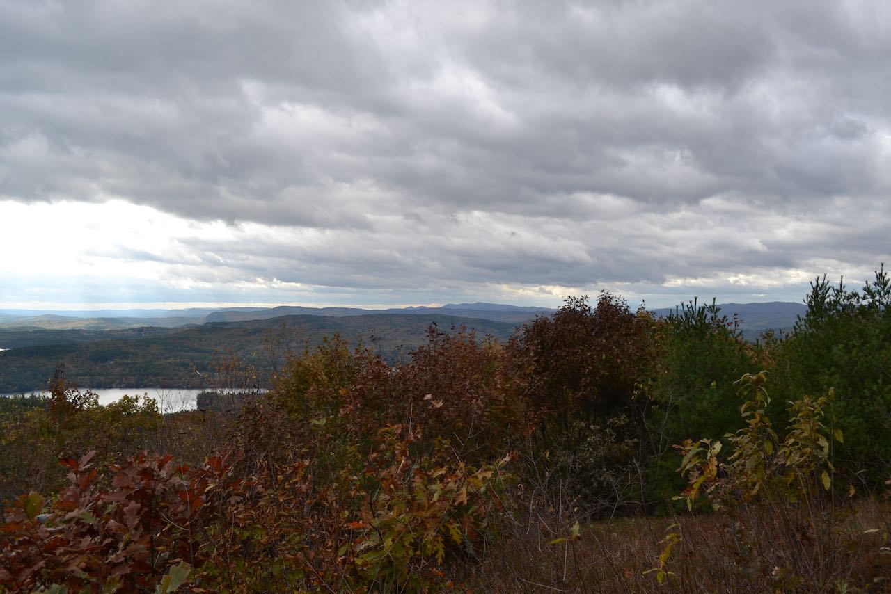
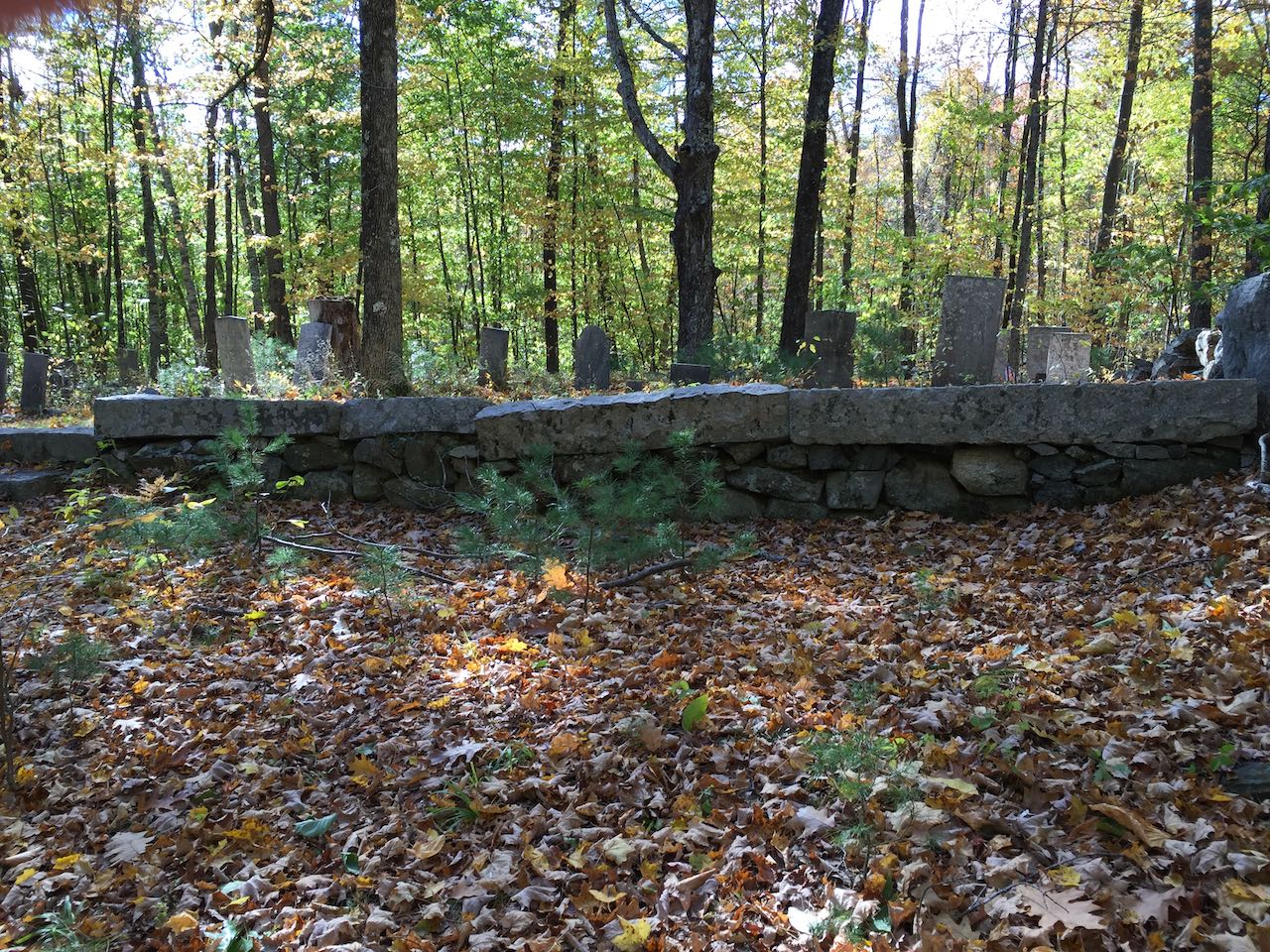
Head across the other side of the summit and continue on the Crawford-Ridgepole Trail as it descends through pleasant open woods along a stone wall, where you can see the rounded shape of the ridge sloping down on both side. A simple walk of 0.4 miles drops you down to the pass between Livermore and Mt. Webster, where Old Mountain Road crosses over the ridge. Turn right and follow this old road bed, now somewhat of a rocky gully eroded into the hillside. The trail descends moderately, eventually narrowing into a footpath along another stone wall, and after 0.45 miles passes the top of an open field where you have a nice view out toward Red Hill. The trail stays along the edge of the field for another quarter mile and then ends at Old Highway, a trail which preserves part of the original main road along the north side of Squam Lake. Turn right and follow the wide, grassy track as it rises over a small hill and then passes a historical cemetery after 0.2 miles. The route descends for 0.3 miles alongside more stone walls, crosses a small brook, and crosses another small rise. Descending again, pass through an area where the old road is severely sunken into the terrain. Emerge at Rt. 113 after half a mile, and walk along the roadside for 0.2 miles back to the trailhead.
Printable directions page